GIS & GPS Projects: Innovative Solutions for Accurate Mapping and Data Analysis
Precision Mapping and Insightful Data for Informed Decision-Making
GIS Analysis for the Hard Rock Drilling Program
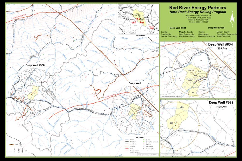
GIS data collection, analysis, and mapping for the Hard Rock Drilling Program in Kentucky in MAGOFFIN & MORGAN COUNTIES, KENTUCKY.
The Meade Gunnel team provided GIS data research, collection, data integration, analysis, and mapping for the Hard Rock Drilling Program. The project utilizies ESRI ArcGIS technology.
GIS Storm Water Residential Impervious Surface
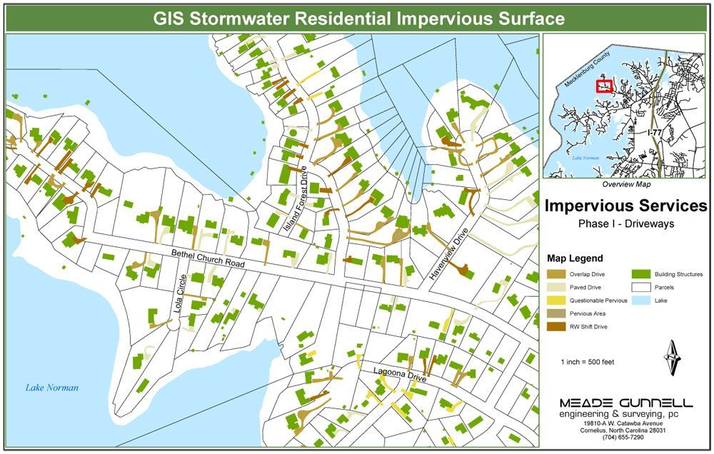
GIS data capture of approximately 55,000 residential impervious areas for EPA Phase II Storm Water compliance in MECKLENBURG COUNTY, NORTH CAROLINA.
MEADE-CIVIL Engineering, PLLC provided GIS professional services for the City of Charlotte (AvioImage) for EPA Phase II Storm Water compliance. The project consisted of heads-up digitizing of approximately 55,000 residential impervious areas from County digital orthophotgraphy to include residential driveways, sidewalks, patios, pools, and sports courts. The resulting GIS dataset is imported into the City of Charlotte GIS database.
GPS Data Capture
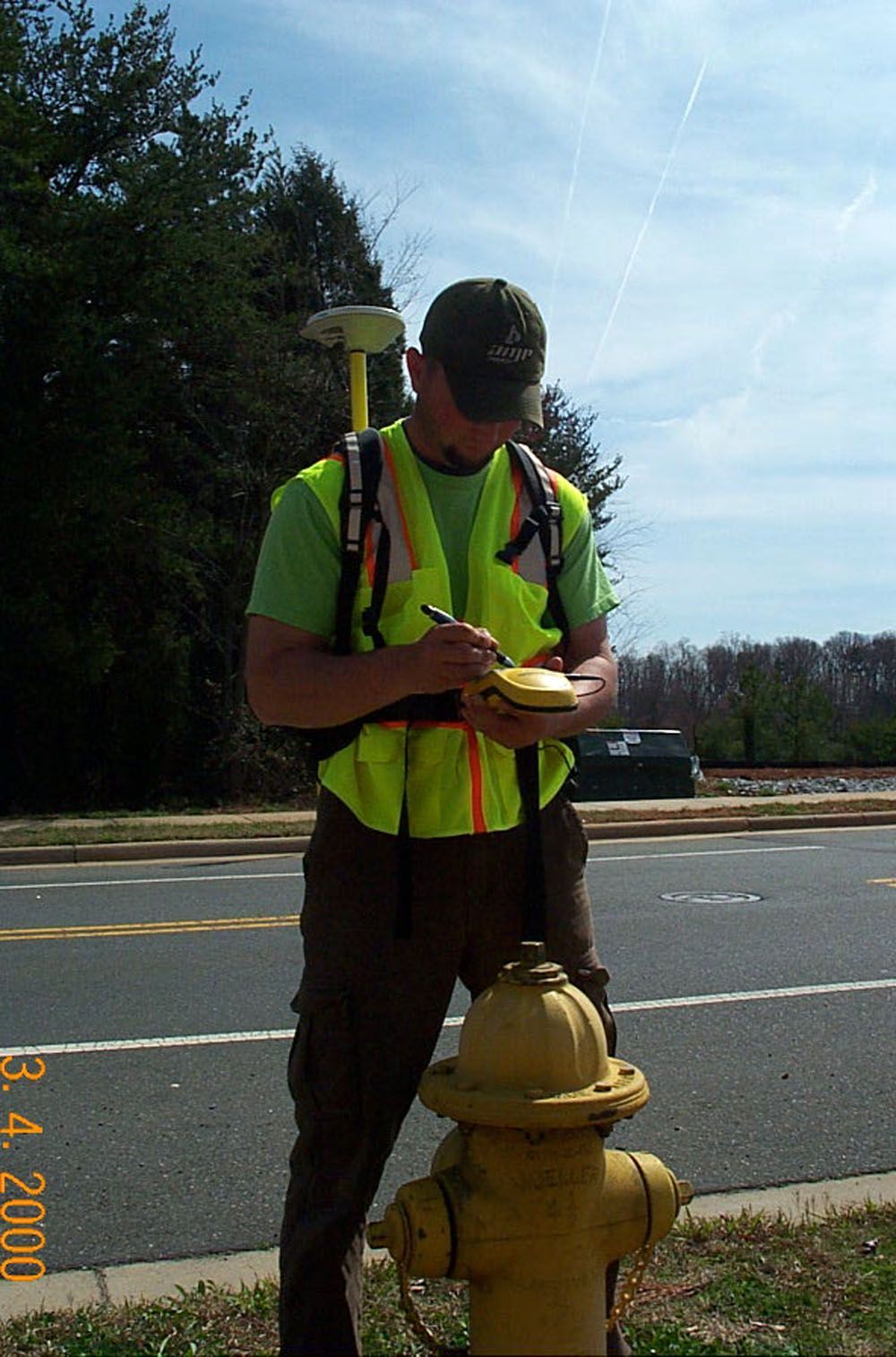

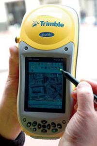
Phase II Data Capture-Mapping grade GPS Locations of infrastructure appurtances such as water valve, water meters blow-off valves, fire hydrants in CHARLOTTE, NORTH CAROLINA.
Phase II Data Capture-Mapping grade GPS Locations of infrastructure appurtances such as water valve, water meters blow-off valves, fire hydrants.
GIS/GPS Storm Water Infrastructure Inventory
GIS/GPS data collection of storm water infrastructure for the Charlotte-Mecklenburg Utilities pilot project in CHARLOTTE, NORTH CAROLINA.
The MEADE-CIVIL Engineering, PLLC GIS/GPS team provided professional services for the Charlotte-Mecklenburg Utilities (Dewberry) pilot project. Services included mapping-grade GPS data collection of all storm water infrastructures. The resulting GIS shapefile dataset was imported into the Charlotte-Mecklenburg Utilities GIS database.
Pikeville Kentucky Office
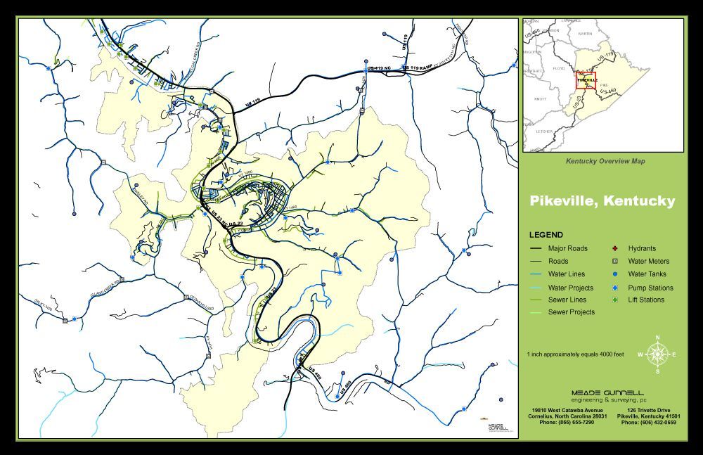
Our Pikeville office is located in eastern Kentucky - PIKEVILLE, KENTUCKY.
Our Kentucky office is located in eastern Kentucky in beautiful Pikeville. The City of Pikeville is home to over 6,500 residents and is the county seat for the largest county in the state of Kentucky with a population of approximately 70,000. Pikeville is the 3rd largest banking community in the State.
GPS Guided Navigation


GPS guided navigation is proven to dramatically improve productivity and efficiency.
GPS guided navigation provides high precision machine guidance. Machines can locate a position within a few centimeters of the cutting edge of the blade. The benefits at mine sites are smooth benches and uniform ramps significantly cut truck cycle times, improve tire life and slash operating costs. The benefits at civil sites excavations are completed to design with no need for field staking and no mistakes or rework.
Benefits of GPS Drill Navigation
- Foster drill movement and keep accurate burden and spacing of drill holes
- Eliminates the need for field pegging of holes giving improved productivity
- Increased accuracy makes for more efficient blasting.
- Angled holes are drilled at the correct angle and orientation
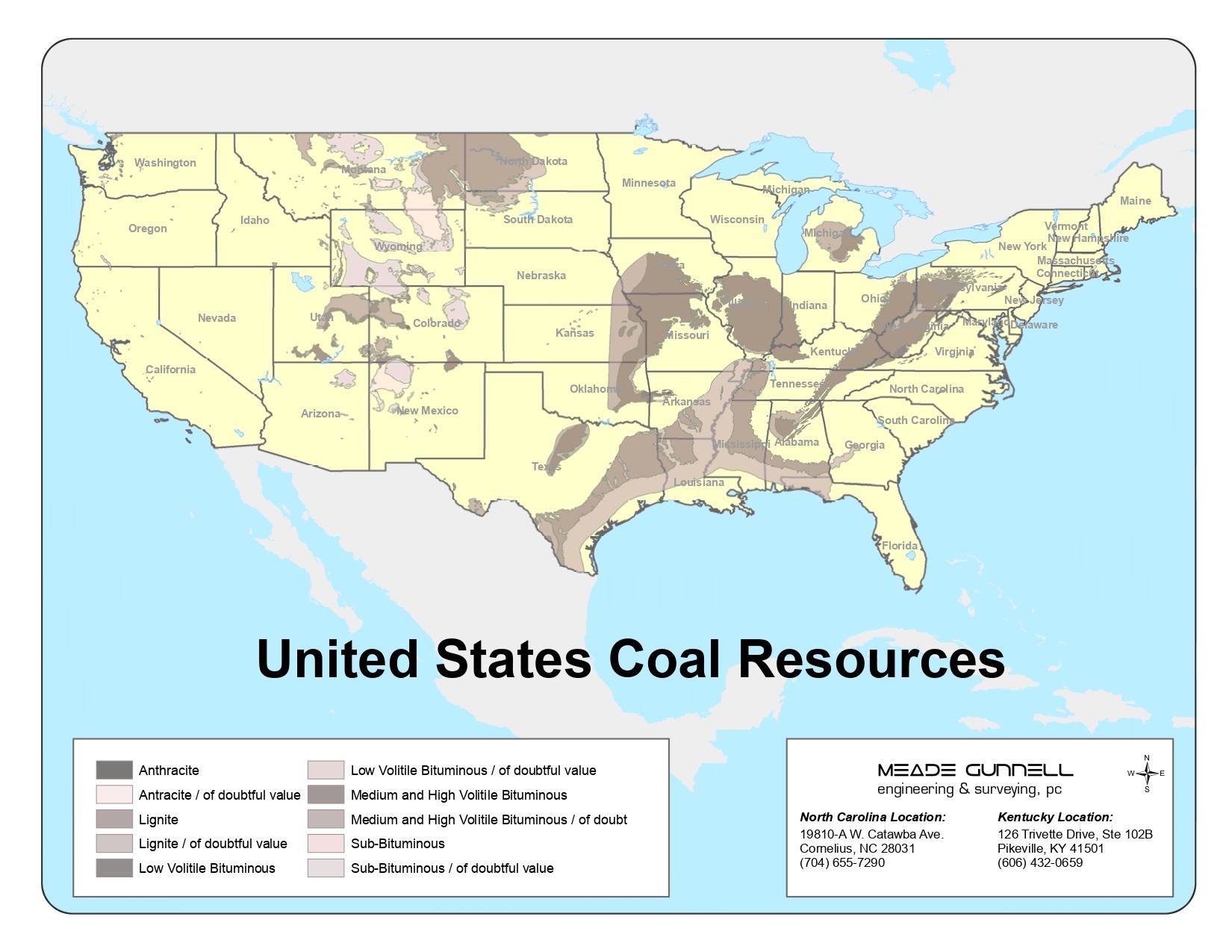
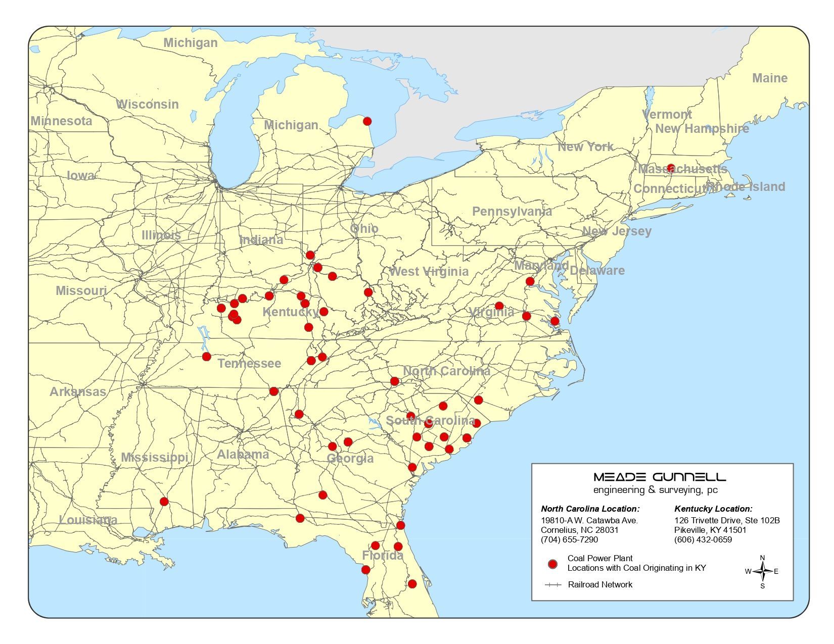
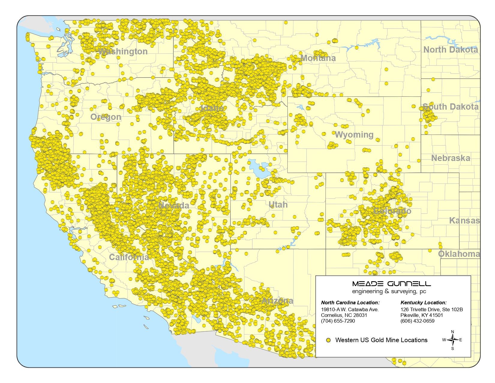
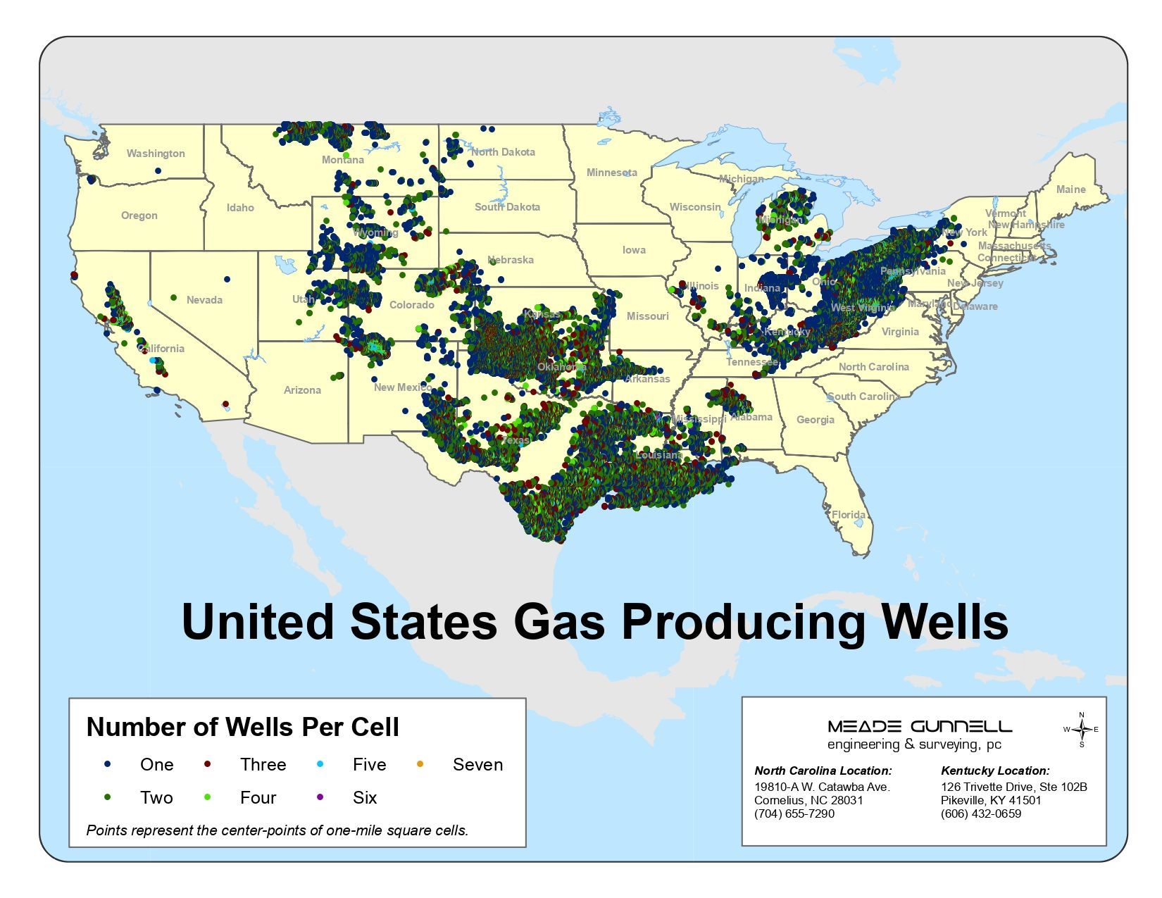
GIS Data Research & Management
The below projects are a representation of our GIS data research, analysis, and management capabilities. We have an extensive array of information resources and expertise.